Mathieson Avenue
North Fremantle
Western suburbs
We design and build custom homes in Mosman Park and across Perth's western suburbs.
Our projects typically start at $1.5M for the build, excluding land. Mosman Park runs from the river to the ocean under one Town and one scheme, and the code changes as you cross it: R12.5 on the river side and in the Buckland Hill and Minim Cove estates, R15 to R20 through the middle, and R40 and above near the railway. This page sets out which rules apply where, and what the Town's views policy, tree controls, laneway policy and the Minim Cove height covenant mean for a new house.
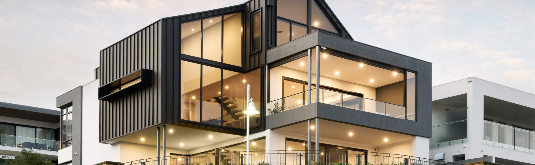
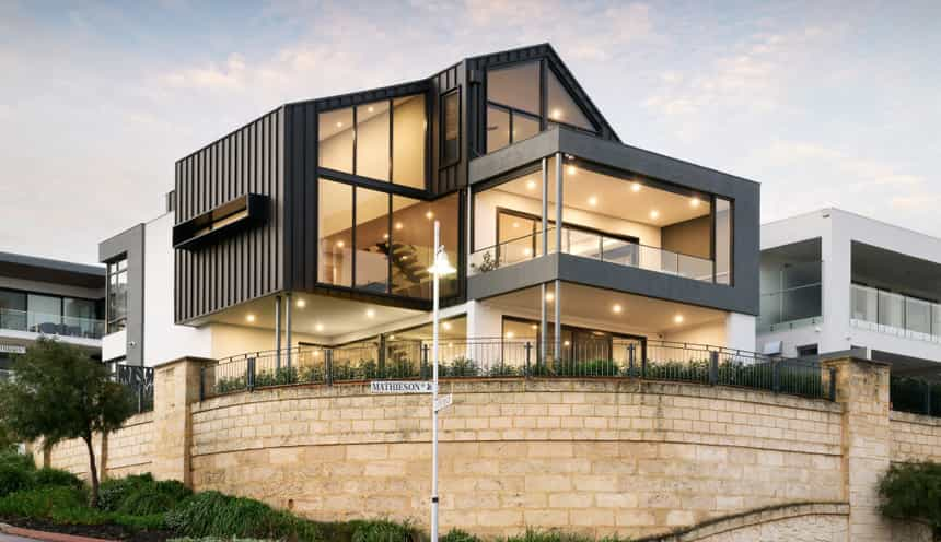
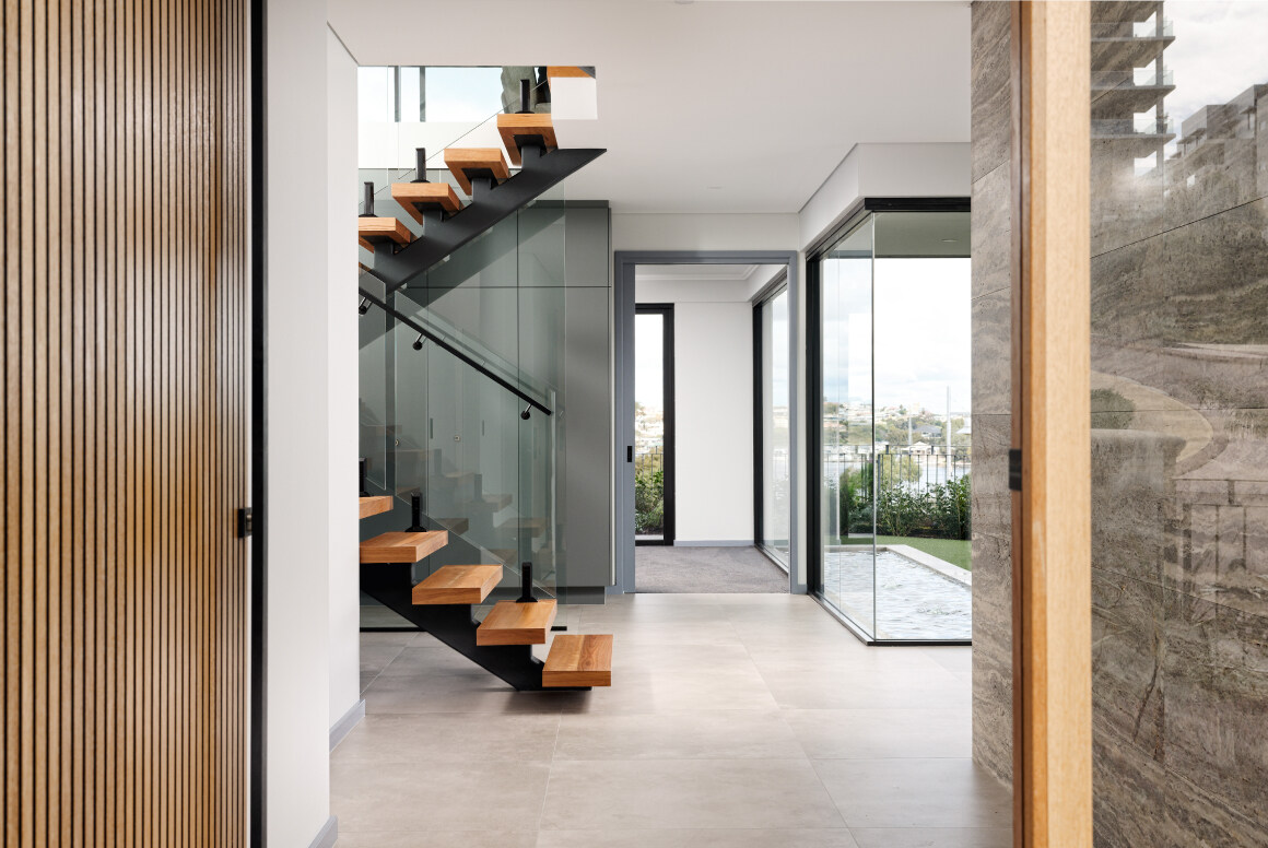
We have not finished a home in Mosman Park yet, so the closest work is next door. Mathieson Avenue in North Fremantle, the adjacent suburb to the south, is a three storey home on a 480 m2 lot, completed in June 2022. Milieu on Mountjoy in Nedlands is five homes on a 1,012 m2 site, finished in 2025.
Private tours of finished and in-progress homes are by invitation. Ask us which homes can be visited.
The scheme and the codes. The suburb and the Town of Mosman Park are the same place. Planning is under Local Planning Scheme No. 3, gazetted on 28 February 2018, which reads in the R-Codes through clause 25 and modifies them in clause 26. As a guide from the scheme map, R12.5 covers the river-side neighbourhood east of Palmerston Street and the Buckland Hill and Minim Cove estates in the south; R15, R17.5 and R20 cover the middle of the suburb, roughly between Palmerston Street and Monument Street and south to Wellington Street; and R40, with R50 and R60 pockets, covers the western side around the railway. Public mapping puts about 11.8% of the suburb's area in R40, 10.3% in R20 and 9.5% in R12.5. The map is hard to read at street level, so check the lot's code on the Town's Intramaps. The scheme has no special control areas (clause 36).
Dual codes and battleaxe lots. Some street blocks carry two codes, R15/25, R20/25 or R12.5/25, and clause 26(4) and (5) decide when the higher one can be used. For the R15/25 lots between Baring and Solomon Streets and the R20/25 lots bound by Samson, Owston, Manning and Beagle Streets, the higher code may be supported where battleaxe arrangements are not proposed. In other named blocks the higher code with a battleaxe arrangement needs a secondary frontage to a parks or public open space reservation, and in two named R25 blocks battleaxe arrangements are not supported at all. If a purchase depends on dividing the lot, read clause 26 for that block with the Town first.
Setbacks and the street. The scheme does not change street setbacks, garage width, fences or open space percentages for a single house on an ordinary lot, so the R-Codes Volume 1 standards apply. One scheme change matters: under clause 26(1), in areas coded R30 or less, a roof terrace is not counted towards open space. Local Planning Policy 49 (adopted 27 October 2026) lets a single house vary some standards without development approval, including up to 500 mm on the minimum or average primary street setback, up to 200 mm on the secondary street setback, and up to 500 mm per wall on side and rear setbacks. A deemed-to-comply check must be lodged to use it, and it does not apply to heritage-listed places or where bushfire requirements apply. Under the Town's Crossover Policy 11.2.2 (adopted 7 March 2014) a crossover is no wider than 6.0 m at the property boundary and at least 0.5 m clear of the boundary, a property has no more than two with a combined width of no more than 50% of the street boundary, and no new crossover is built within 6.0 m of a corner. Stormwater must be contained on site.
Laneways. The Town has 72 laneways, and Local Planning Policy 04 (adopted 26 November 2019, version 2 dated 26 November 2020) applies to every lot that shares a boundary with one. For those lots it replaces R-Codes Volume 1 clauses 5.1.2, 5.2.1, 5.2.2 and 5.2.4 with its own standards, with the setback and garage width figures in the policy's tables, and where a lot on a Primary Laneway has no other street, the laneway is treated as the primary street. A fence to a Primary Laneway is solid to 1.2 m and 50% visually permeable above that, to a maximum of 1.8 m. On a Primary Laneway only front-and-back subdivision is supported, on a Secondary Laneway only side-by-side, and battleaxe subdivision of a lot adjoining a laneway is not supported. Where a laneway narrower than 6 m is to be widened, the subdivider cedes a strip of land free of cost, capped at 40 m2 for a residential lot under 1,000 m2. Ask the Town for the laneway's class and the figures that go with it.
Height. The scheme sets heights only for the Commercial, Mixed Use and Centre zones, so a house in the Residential zone is held to R-Codes Volume 1 (Version 3, published 10 April 2026), Category B: a 7 m wall, and a total of 8 m for a gable, skillion or concealed roof or 10 m for a hipped and pitched roof. Local Planning Policy 40 Views of Significance (adopted 26 May 2026) applies when an application goes over that height and significant views may be affected. It names views of the Indian Ocean, the Spit at Point Walter, the Swan River and the Perth city skyline, and the Town may ask for a licensed surveyor's viewshed analysis and 3D modelling. A house within the deemed-to-comply height is outside the policy.
Minim Cove. The Minim Cove Estate Design Guidelines, Local Planning Policy 03 (adopted 25 July 2017), work differently. Height is limited to 8.5 m above a datum level set for each lot on the estate's Outline Development Plan, applied through restrictive covenants, and chimneys, lift overruns, air conditioners and hot water systems cannot protrude above it. Lots adjoining the foreshore reserve have a minimum setback of 10.0 m from the southern boundary, with named exceptions, and no vehicle access to the reserve. Garage width is capped at 6.5 m on R25 and R30 lots, nothing can be built in a retaining wall's structural setback area without an engineer's certificate and Council approval, domestic bores are not permitted, and fibro-cement fences are not permitted in the front and rear setback or on a side boundary common to public areas. Read the title for covenants before you buy.
Trees. Scheme Amendment 12, gazetted on 22 May 2026, deleted the significant tree register and the exemption that had let other trees be removed without planning approval. Local Planning Policy 43 Tree Preservation on Private Property now does the work. The Town describes a regulated tree as one with a height of 8 m or more, a canopy at least 6 m wide, or a trunk circumference of 1.5 m or greater, measured 1.4 m from the ground, and the policy excludes weed species and palms. A development application is required for tree damaging activity where other works are proposed on the same site, even if those works are otherwise exempt. The policy carries a general presumption against damaging a regulated tree, will not accept impact on views as a reason, and may consider removal where an arborist shows the tree is unhealthy or unsafe or where redesigning around it is unfeasible. For street trees, the Street Tree Management Policy (version 6, 28 May 2024) considers removal only when no other reasonable design alternative exists, requires three new trees for each one removed at the applicant's cost, and holds a bond of 10% of the tree's amenity value, with a minimum of $500, during works.
Heritage. Council adopted a new heritage framework on 27 August 2024: a Local Heritage Survey, a Heritage List and Local Planning Policy 34 Management of Heritage Places. Category 1 and 2 places are on the Heritage List, and any modification, addition or demolition of a listed place needs planning approval. The list includes houses on Glyde Street (No. 50 and Nos 64 to 80), Murray Avenue, Bay View Terrace, Hill Terrace and Victoria Street. Policy 34 carries a presumption against demolition of any listed place, a Heritage Impact Assessment by a heritage professional must accompany an application, and the Town may ask for more information where the lot next door is listed. The Town has no heritage areas.
River, coast and bushfire. About 7.7% of the suburb's area is in the Swan Canning development control area. If the lot is on the river side, check with the Department of Biodiversity, Conservation and Attractions and the Town what applies before you design. About 20.3% of the suburb's area is mapped bushfire prone: the Town names the remnant bushland at Buckland Hill and the foreshore at Minim Cove and Point Chidley, and a Bushfire Attack Level assessment or management plan may be required for new development there. On the ocean side the Town has no adopted coastal hazard plan. Its draft Local Planning Strategy records erosion risk to the Mosman Beach area, including land east of Curtin Avenue, between 2051 and 2091, and proposes that the Town prepare one. We could not establish which residential lots, if any, are affected, so ask the Town if the lot is near the coast. We found no published flood mapping.
Demolition and knockdown rebuild. The Town requires planning approval for demolition only where the building is heritage listed or on the State Register, although a development application is also needed if a regulated tree would be damaged. Demolition permit applications are processed within 10 working days. An Infrastructure Protection Bond is required for every demolition permit application, and it is not transferable to the building permit, so a knockdown rebuild pays a bond twice. Using the verge for materials, bins or cranes needs a Permit for Activity on Thoroughfare, and removing a pool or spa needs a decommissioning form and an inspection. Under Local Planning Policy 24 (adopted 23 August 2022) a Construction and Demolition Management Plan may be required where the site is next to a laneway, street parking is restricted or the roads are narrow. The ABS recorded 21 new house approvals in the Mosman Park - Peppermint Grove statistical area in the 12 months to September 2026, the same as the year before.
Rules in motion. The State's Station Precincts Improvement Plan No. 65, which the WAPC resolved on 17 June 2026, covers land generally within 800 m of eight stations, Mosman Park among them. It is not yet a set of rules: the Town says the plan itself introduces no new zoning, building heights or development controls. Those are to come in an improvement scheme, due for public comment later in 2026 and to be finalised in mid-2027, which will replace Local Planning Scheme No. 3 inside its boundary, with decisions administered by the Department of Planning, Lands and Heritage for the WAPC. As a guide from the precinct plan, the boundary follows Johnston Street on the north, Solomon Street and then a line near Glanville Street on the east, and Wellington Street on the south, which leaves the river-side R12.5 streets east of Solomon Street and the Buckland Hill and Minim Cove estates south of Wellington Street outside it. That reading is for orientation only, so check the lot. [CONFIRM: whether the draft Station Precincts Improvement Scheme has been released for public comment, and where its boundary runs through Mosman Park, before this page is published] Separately, Council resolved on 24 February 2026 to support a new Local Planning Strategy and send it to the WAPC, and we have not found a WAPC endorsement. The draft proposes reviewing the small pockets of R15/25 and R20/25. Policy 49's exemptions for open space, outdoor living area and visual privacy are marked as subject to WAPC approval. Rules change. Confirm the current codes for your lot with the Town of Mosman Park or with us before you buy or design.
| Measure | Figure | As at | Source |
|---|---|---|---|
| New houses approved, 12 months | 21in the Mosman Park - Peppermint Grove statistical area (21 the year before) | October 2025 to September 2026 | ABS Building Approvals |
| Residential density codes | About 11.8%of the suburb area R40, 10.3% R20, 9.5% R12.5 | Sampled 10 November 2026 | DPLH via Landgate SLIP |
| Bushfire-prone mapping | About 20.3%of the suburb area; check the lot | Sampled 10 November 2026 | DFES via Landgate SLIP |
| Swan Canning development control area | About 7.7%of the suburb area, along the river | Sampled 10 November 2026 | DBCA via Landgate SLIP |
| Separate houses | 54.9%of private dwellings | 2021 Census | ABS |
| Population | 9,169 | 2021 Census | ABS |
Figures are for the suburb or statistical area named. Area shares are grid estimates from public mapping and are not lot designations.
For current median sale prices, see REIWA's Mosman Park suburb profile.
Our projects typically start at $1.5M for the build, excluding land. Our cost guide puts a Trendsetter home at $4,000 to $6,000+ per square metre, with builds from $1.5M to $4M. In Mosman Park the first question is which part of the suburb the lot is in. On the R12.5 river-side streets and in the Buckland Hill estate the R-Codes set the envelope, and the practical choice is height: a house within the 7 m wall and the 8 m or 10 m total stays outside the views policy, and one that goes over it invites a viewshed analysis. A roof terrace cannot be used to make up the open space percentage on a lot coded R30 or less. In Minim Cove the 8.5 m limit is measured from the lot's datum and sits on the title, so the levels and the covenant are read before anything is drawn. On a laneway lot the laneway's class decides the setbacks and how the lot can be divided. Anywhere in the suburb, a regulated tree in the building area or a heritage listing next door is something the design starts from.
Trendsetter Homes has designed and built custom homes across Perth since 1997. Design, construction and interiors are handled by one team, so the people who draw your home are the people who build it, and the interior designer is in the room from the first brief. Before you commit, we show you real homes: private tours of finished and in-progress client homes, by invitation, with no obligation. Many clients talk to us before they buy a block, and that is a good time to start.
Design, construction and interiors are one team. These are the people you meet first.
Mosman Park is a Town of one suburb, so the rules on this page stop at its boundary: Peppermint Grove has its own Shire and scheme, and Cottesloe is in the Town of Cottesloe.
Nearby: Peppermint Grove, North Fremantle, Cottesloe, Claremont, East Fremantle.
Elsewhere in the western suburbs: Churchlands, City Beach, Dalkeith, Floreat, Mount Claremont, Nedlands, Shenton Park, Subiaco, Swanbourne, Wembley, Wembley Downs, West Leederville, Woodlands.
All areas: see every suburb we have written up.
On an ordinary residential lot the R-Codes Category B heights apply: a 7 m wall, and a total of 8 m for a gable, skillion or concealed roof or 10 m for a hipped and pitched roof. Local Planning Scheme No. 3 sets heights only for the Commercial, Mixed Use and Centre zones. In Minim Cove a restrictive covenant limits height to 8.5 m above the datum level set for the lot.
Only when a proposal goes over the deemed-to-comply height. Local Planning Policy 40 then lets the Town assess the effect on views of the Indian Ocean, the Spit at Point Walter, the Swan River and the Perth city skyline, and ask for a viewshed analysis and 3D modelling. A house within the R-Codes height is outside the policy.
Not without approval if it is a regulated tree, which the Town describes as one 8 m or more high, with a canopy at least 6 m wide, or with a trunk circumference of 1.5 m or greater. Local Planning Policy 43 requires a development application where other works are proposed on the site and presumes against removal. Impact on views is not accepted as a reason.
Local Planning Policy 04 applies to every lot that shares a boundary with one of the Town's 72 laneways and replaces several R-Codes clauses for it, with setback and garage width figures in the policy's tables. Battleaxe subdivision of a laneway lot is not supported, and the subdivider may have to cede a strip of land if the laneway is to be widened. The laneway's class decides the detail, so ask the Town for it.
About 20.3% of the suburb's area is mapped bushfire prone, around Buckland Hill and the foreshore at Minim Cove and Point Chidley, and a Bushfire Attack Level assessment may be required there. About 7.7% of the suburb's area is in the Swan Canning development control area. Both are area estimates, so check the lot, and for a river-side lot check with the Department of Biodiversity, Conservation and Attractions and the Town.
Book a design meeting at our Osborne Park office, or request a private tour of a finished or in-progress home. Office (08) 9446 2822. For tours, call Marek on 0412 688 079. Or use the enquiry form below.
Client reviews
“From the outset Michael was very clear about their process and costing. … The quality of materials and workmanship are excellent. In addition, there was good communication and any queries we had were responded to quickly. We highly recommend Trendsetter Homes.”
“We can’t praise Michael Agostino and his great team enough for making the journey as drama-free as possible. Michael’s experience, knowledge and attention to detail are outstanding.”
“From design with Anthony, he was amazing and hit all of our needs and provided a really good layout that worked well for us. … There was open communication throughout the build which made the build a lot easier.”
“They are great to work with, very professional and attentive to detail. We highly recommend Trendsetter Homes for anyone looking for a builder who build quality homes and is reliable and trustworthy.”