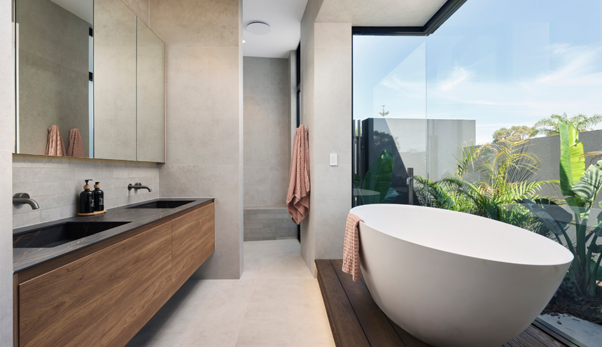
Sheppard Way
Marmion
Coast
We design and build custom homes in Watermans Bay and across Perth's coast.
Our projects typically start at $1.5M for the build, excluding land. Watermans Bay is small: six R20 streets running from West Coast Drive to Hope Street, with the ocean at one end and Star Swamp Reserve at the other. This page covers the three things buyers ask about here: whether a coastal height limit applies to a house (it does not), what the City's coastal hazard plan says about an erosion hotspot, and which lots to check for bushfire mapping.
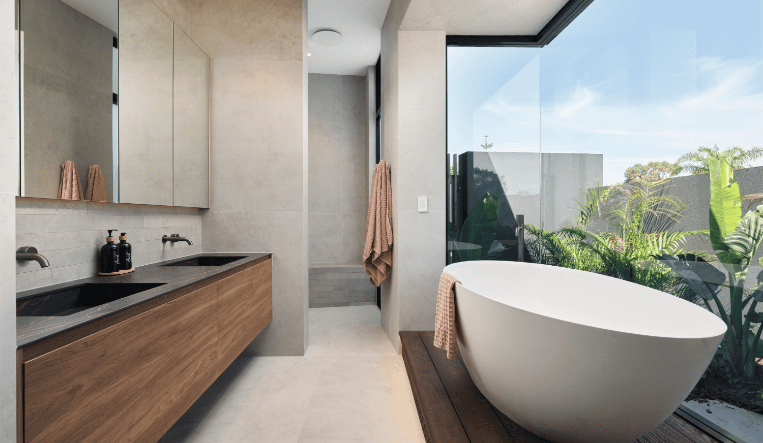
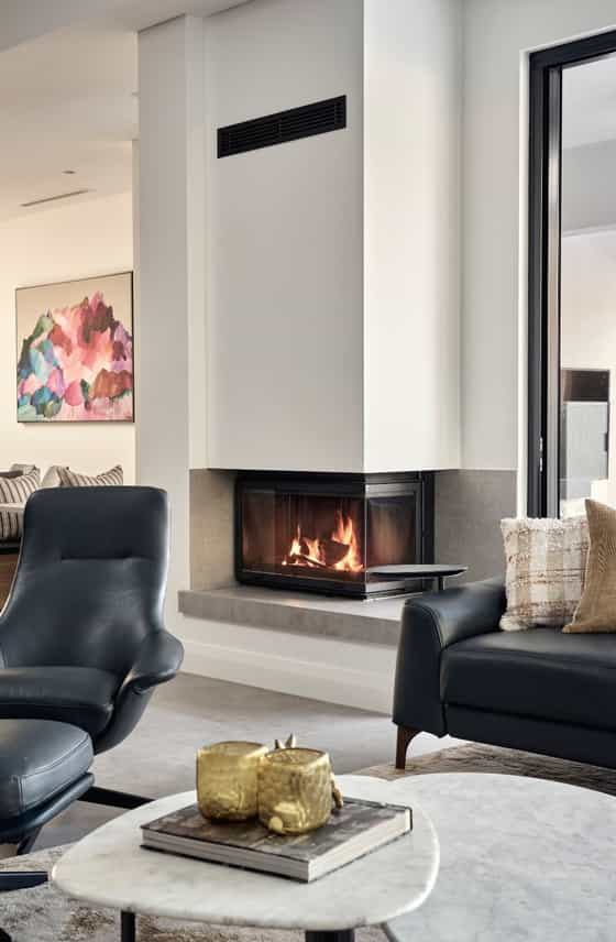
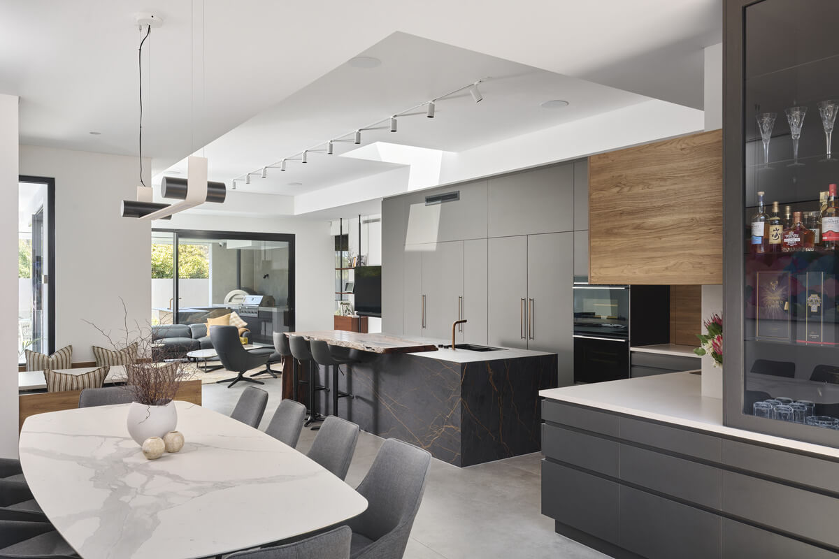
We have not built a home in Watermans Bay yet. The closest finished home is Sheppard Way in Marmion, the next suburb to the north, on a 777 m2 lot and completed in February 2025. Brown Way in Karrinyup, also in the City of Stirling, is a home on a 373 m2 lot with completion expected in 2027.
Private tours of finished and in-progress homes are by invitation. Ask us which homes can be visited.
The scheme and the codes. Watermans Bay is in the City of Stirling under Local Planning Scheme No. 3, gazetted on 6 August 2010, with the City's copy of the text last updated on 12 June 2026. The state's scheme map for the Carine locality (Map 1, plotted 8 July 2025) shows the blocks from Beach Road south to Hale Street, between West Coast Drive and Hope Street, zoned Residential and coded R20. The streets are Elsie, Mary, Ada, Margaret, Elvire and Hale, crossed by Flora Terrace and Ethel Street. One Local Centre lot sits on West Coast Drive at Elsie Street. East of Hope Street the land is reserved for Parks and Recreation. Public mapping puts about 29.8% of the suburb's area in R20, and the rest carries no residential code. Beach Road is the City of Stirling's northern boundary, with the City of Joondalup beyond it. The suburb boundary with North Beach does not follow one street: Landgate's locality boundary crosses Hale Street, Hope Street and Hugh Street, so part of each is in North Beach. Confirm the lot's suburb and code on the City's online mapping.
The lot pattern. The City's suburb profile says the area was subdivided as the Mt Flora Estates in 1918, that early building was largely holiday shacks, that the area had reached its development potential by the late 1960s, and that new homes began replacing the shacks in the 1970s. At R20 the R-Codes (Volume 1, Version 3, published 10 April 2026) set a minimum site area of 350 m2, an average of 450 m2 and a 10 m minimum frontage, with 450 m2 the minimum for a battleaxe lot. Scheme clause 5.2.2 requires houses to conform with those codes.
Setbacks and the street. The City has no local policy that changes street setbacks, garage width, open space or front fences here; its former Streetscapes and Single Houses policies were revoked in 2016 and 2017. The R20 standards therefore apply: a 6 m primary street setback, 1.5 m to a secondary street (relevant to corner lots on Flora Terrace and Ethel Street), 50% open space and a 30 m2 outdoor living area. Local Planning Policy 6.15 adjusts a few standards across the City. Nothing higher than 0.75 m may sit within 1.5 m of where a driveway meets a street or two streets intersect, apart from limited fencing, and outbuildings are held to 60 m2 or 10% of the site in total, with a 3.0 m wall and a 4.2 m ridge. Its allowance for longer boundary walls applies only to lots coded R30 and higher, so it does not change the R20 standard. A front fence needs no development approval if it is solid to no more than 1.2 m, visually permeable above that and no more than 1.8 m overall, with piers no larger than 400 mm by 400 mm (City information sheet, March 2023); a masonry street wall higher than 0.75 m needs a building permit.
Height. There is no coastal height limit on a Watermans Bay house lot, although many buyers expect one. Local Planning Scheme No. 3 has one coastal height control, clause 6.3, and by its title it covers non-residential zones: it requires extra information and advertising for a building over 12 m in those zones. We could not verify whether the Local Centre lot at Elsie Street is inside that area. For houses, the City revoked its residential height policy on 20 February 2023, and its Single House sheet refers to R-Codes clause 5.1.6 and Table 3, Category B. That gives a maximum wall height of 7 m and a total building height of 8 m for a gable, skillion or concealed roof or 10 m for a hipped or pitched roof. No view corridor, ocean view or view sharing policy was found for residential lots in the City.
Trees. The older Stirling rule that tied tree planting to developments worth more than $100,000 is no longer the position for houses: the City's policy list has no Trees and Development policy, and the $100,000 threshold now applies to non-residential development only. A new house is assessed on R-Codes clause 5.3.2, which requires one tree in a planting area of at least 2 m by 2 m and no more than 50% impervious surface in the street setback area. The City's Single House sheet asks for a 9 m2 deep soil zone for a new advanced tree, a figure that differs from the R-Codes, so check with the City which applies. Scheme clause 5.13 still allows the City to require retention of established trees, or one advanced tree for every 500 m2 of site, as a condition where a development application is needed. A tree on the City's Significant Tree Register (Schedule A, clause 13B) cannot be removed without development approval, but trees are registered only on the owner's nomination. The City Trees Policy says street trees will not be removed to allow development on private land, and it sets crossover clearances from a City tree of 1 m for a trunk up to 200 mm in diameter, rising to a minimum of 4 m for 601 mm or more.
Heritage. The City's Heritage List (August 2025) has one Watermans Bay entry, the former Marine Research Laboratory at 86 West Coast Drive, Category B. We found no State Register place in the suburb and no heritage area. If a place is on the Heritage List, demolition needs development approval first and the application is advertised.
The coast. Watermans Bay is management unit 1 in the City's Coastal Hazard Risk Management and Adaptation Plan, which runs from Beach Road to Hale Street. The plan is dated 23 June 2023 and listed by the City as endorsed in August 2023. Watermans Bay was one of 55 coastal erosion hotspots in the State's 2019 assessment, and the plan rates it at high risk of erosion now. What it lists at risk is public: the beach and dog beach, the dunes, the geotextile sand container revetment, West Coast Drive with its footpath and services, the lookout and amenities, and the Margaret Street car park. According to the City's coastal planning documents, the existing revetment "reduces the likelihood of impact to assets on its landward side, including vegetated dunes, a portion of West Coast Drive and the Watermans Bay lookout". On private land, its implementation chapter says: "There is no immediate need for the City to prepare a Planned or Managed Retreat Policy given the erosion hazard lines are not expected to impact assets on private properties within the 100-year planning timeframe". So in this version of the plan no hazard line, special control area or title notification applies to private lots. The plan is to be revised at 10 yearly intervals, and it recommends that if a later revision finds private properties intersected, the City should explore a special control area and notify owners, including on titles. The plan describes the City's northern shoreline as bluff-dominated with perched beaches and nearshore reefs, and records rock at varying levels along West Coast Drive that gives much of that coastline a level of protection.
Star Swamp and bushfire. The City's profile says Star Swamp Reserve occupies a large portion of Watermans Bay, covers about 96 hectares and was declared an A Class Reserve in 1987. It is also a Bush Forever site. Public mapping puts about 59.4% of the suburb's area in the bushfire-prone area, but that is a share of the whole suburb including the reserve, not a share of house lots. A bushfire-prone area takes in the vegetation and a 100 m buffer, so the lots to check on the DFES map are those on and near Hope Street and at the east ends of Mary, Ada, Margaret and Elvire Streets. Where a lot is mapped, the City's information sheet says a single house on less than 1,100 m2 needs a Bushfire Attack Level (BAL) assessment with the building permit and no development application; on 1,100 m2 or more a development application is required, and one is required at any lot size if the rating is BAL-40 or BAL-FZ. The City does not do BAL assessments itself.
Demolition and knockdown rebuild. The City's demolition checklist limits the need for planning approval to heritage cases, so an unlisted house needs only the demolition permit. The permit fee for a house is $121.00, plus the Building Services Levy at 0.137% of the value of the demolition work with a minimum of $61.65. The application needs the BA5 form signed by all owners, a completed asbestos assessment form, disconnection notices to the service providers (water stays on for dust suppression), confirmation from a plumber that drainage is cut and sealed, a rat baiting letter and the bins returned. Water Corporation approval is needed where work is near or over a sewer or water main. A verge permit applies to any demolition or building work, with a $200 inspection fee and a refundable bond of $1,000, $2,000 or $4,000 depending on whether there is a street tree and how large it is. The ABS recorded 26 new house approvals in the Trigg - North Beach - Watermans Bay statistical area in the 12 months to September 2026, against 45 the year before.
Rules in motion. The City's project page records sand nourishment as the preferred short to medium term option for Watermans Bay, with Council decisions on 27 May 2025 and 31 March 2026, and a Coastal Protection Working Group was formed in March 2026. Draft Local Planning Scheme No. 4 was advertised from 18 October 2024 to 24 January 2025, supported by Council with modifications on 10 June 2025 and accepted by the Department of Planning, Lands and Heritage for final assessment on 18 June 2025; the City's page, last updated on 4 August 2026, still describes it as not yet gazetted. [CONFIRM: whether the Minister has decided or gazetted Local Planning Scheme No. 4 since the City's page was updated on 4 August 2026] The City says the draft generally proposes no density code changes. It reduces the special control areas from 17 to 1, which drops the coastal height area for non-residential zones, and it includes no coastal special control area. Closer to home, the City has applied for Black Spot funding for parking and safety at Mary Street and Flora Terrace. Rules change. Confirm the current codes for your lot with the City of Stirling or with us before you buy or design.
| Measure | Figure | As at | Source |
|---|---|---|---|
| New houses approved, 12 months | 26in the Trigg - North Beach - Watermans Bay statistical area (45 the year before) | October 2025 to September 2026 | ABS Building Approvals |
| Residential density codes | About 29.8%of the suburb area R20 | Sampled 10 November 2026 | DPLH via Landgate SLIP |
| Bushfire-prone mapping | About 59.4%of the suburb area; check the lot | Sampled 10 November 2026 | DFES via Landgate SLIP |
| Separate houses | 60.2%of private dwellings | 2021 Census | ABS |
| Population | 1,369 | 2021 Census | ABS |
Figures are for the suburb or statistical area named. Area shares are grid estimates from public mapping and are not lot designations.
For current median sale prices, see REIWA's Watermans Bay suburb profile.
Our projects typically start at $1.5M for the build, excluding land. Our cost guide puts a Trendsetter home at $4,000 to $6,000+ per square metre, with builds from $1.5M to $4M. Every house street on the scheme map here is R20, so the starting envelope is the same from Elsie Street to Hale Street: 6 m back from the street, half the site open, a 7 m wall, and a roof form chosen knowing that a hipped or pitched roof may reach 10 m and a concealed or skillion roof 8 m. Corner lots on Flora Terrace and Ethel Street also work to the 1.5 m secondary street setback and the 0.75 m sight line rule at the intersection. What differs is which end of the street the lot is on. Towards Hope Street the first job is the DFES map and, if the lot is mapped, a BAL assessment before the design is fixed. Towards West Coast Drive the question buyers raise is erosion, and the answer for now is the 2023 plan's finding on private property, which we would re-check with the City at the time of purchase.
Trendsetter Homes has designed and built custom homes across Perth since 1997. Design, construction and interiors are handled by one team, so the people who draw your home are the people who build it, and the interior designer is in the room from the first brief. Before you commit, we show you real homes: private tours of finished and in-progress client homes, by invitation, with no obligation. Many clients talk to us before they buy a block, and that is a good time to start.
Design, construction and interiors are one team. These are the people you meet first.
Beach Road is the City of Stirling's northern boundary, with the City of Joondalup beyond it, so the scheme and policies change once you cross it; Trigg and Karrinyup are in the City of Stirling under the same scheme as Watermans Bay.
Nearby: Marmion, Trigg, Karrinyup, Ocean Reef.
Elsewhere on the coast: North Coogee, North Fremantle.
All areas: see every suburb we have written up.
No. Clause 6.3 of Local Planning Scheme No. 3 is a coastal height control for non-residential zones and concerns buildings over 12 m. A house on an R20 lot follows R-Codes Table 3, Category B: a 7 m wall and a total of 8 m for a gable, skillion or concealed roof, or 10 m for a hipped or pitched roof.
Not under the current plan. The City's coastal hazard plan, dated 23 June 2023, rates Watermans Bay at high risk of erosion now, but the assets it lists are public ones such as the beach, dunes, revetment and West Coast Drive. It says the erosion hazard lines are not expected to impact assets on private properties within the 100 year planning timeframe, and no special control area or title notification applies. The plan is revised at 10 yearly intervals, so check the current version.
It may be. A bushfire-prone area includes the mapped vegetation and a 100 m buffer, so lots on and near Hope Street and the east ends of Mary, Ada, Margaret and Elvire Streets should be checked on the DFES map. The 59.4% figure in the table is a share of the whole suburb, reserve included. On a mapped lot under 1,100 m2 the BAL assessment goes in with the building permit.
Not for an unlisted house. The City of Stirling's checklist asks for a development application only in heritage cases, and the one Heritage List entry in Watermans Bay is the former Marine Research Laboratory at 86 West Coast Drive. You still need the demolition permit at $121.00 plus the Building Services Levy, and a verge permit with a refundable bond.
Book a design meeting at our Osborne Park office, or request a private tour of a finished or in-progress home. Office (08) 9446 2822. For tours, call Marek on 0412 688 079. Or use the enquiry form below.
Client reviews
“From the outset Michael was very clear about their process and costing. … The quality of materials and workmanship are excellent. In addition, there was good communication and any queries we had were responded to quickly. We highly recommend Trendsetter Homes.”
“We can’t praise Michael Agostino and his great team enough for making the journey as drama-free as possible. Michael’s experience, knowledge and attention to detail are outstanding.”
“From design with Anthony, he was amazing and hit all of our needs and provided a really good layout that worked well for us. … There was open communication throughout the build which made the build a lot easier.”
“They are great to work with, very professional and attentive to detail. We highly recommend Trendsetter Homes for anyone looking for a builder who build quality homes and is reliable and trustworthy.”